


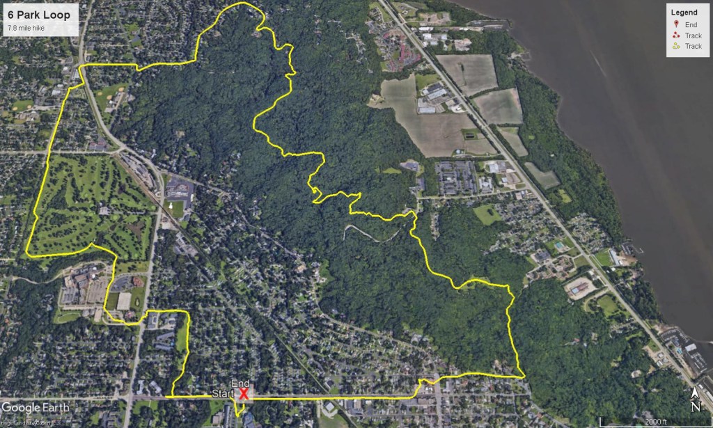
Overview
- Length: 7.8 miles
- Elevation gain / loss: +930 ft / – 930ft
- Surface: mix of woodland trail, park lawns, sidewalks, and residential street
- Trip start location: Peoria Heights High School – 508 E Glen Ave, Peoria Heights, IL
This loop route takes you on a long but rewarding trek through some of the best hiking the Peoria Park District has to offer. It offers the diversity of a deep woodland trails and smaller but very scenic city parks with interconnections made on sidewalks though some very architechually diverse neighborhoods. This hike is best to do when conditions are dry as there are some lower lying areas that could be very mucky after or during a rain. If you follow the route clockwise as described in the guide, the most demanding part will come in the last half of the journey so be sure to pace yourself. The route may all be in the city limits of Peoria and Peoria Heights but it still requires the planning and preperaration that any hike of this lenght demands. See by the mile route guide below.
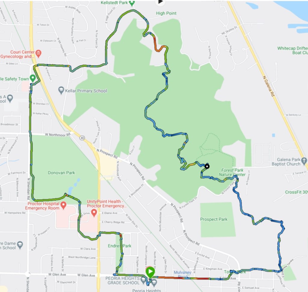
Turn by Turn Directions – Clockwise
mile 0.0 START Park at the Peoria Heights High School parking lot along E Glen Avenue, Peoria Heights, IL. Start the journey by hiking across E Glen Ave then turn left (west) onto the sidewalk along the north side Glen Avenue. Proceed west, down the sidewalk.
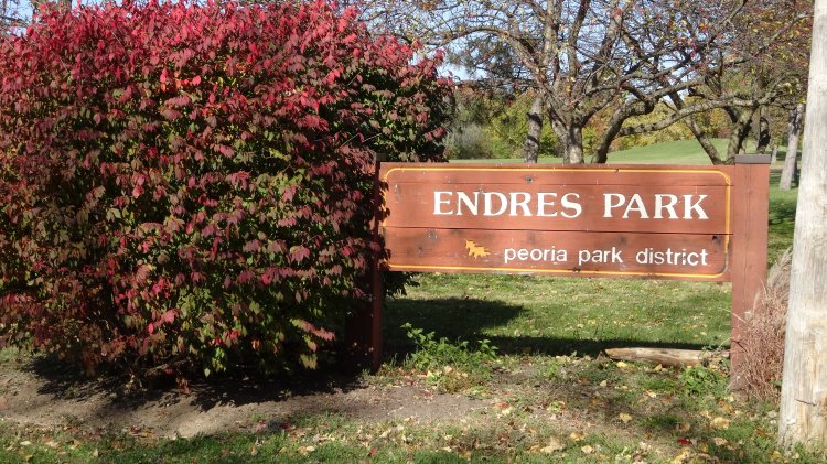
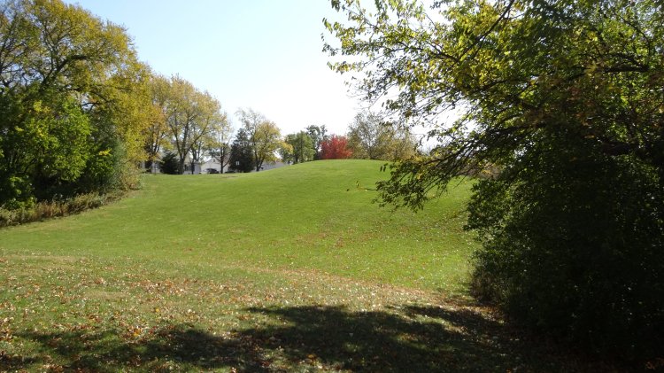
mile 0.3 After you pass N Conn Ave look for the steel handrail along the sidewalk. Stop at the handrail and turn right (north) into the woods. You must first carefully scramble down a very short but steep embankment. This is the edge of Endress park, but is an undeveloped area. Follow a faint path that leads you into the main part of the park as you walk straight north. Hike north through the park (about 1/3 mile total) along the grass passing a picnic shelter on the left. As you exit the park, you will go up and then down a sledding hill.
mile 0.7 Exit Endress park on to E Frances Ave. Turn left (west) .
mile 0.85 Cross busy Knoxville avenue carefully at a safe place. Proceed left (south) on Knoxville then turn right into W Belcrest Drive. There will be a sign for the Hult Center on the right.
mile 1.2 After following Belcrest drive through the Unity Point Medical Center you need to head for the treeline behind Unity Point Hospital. There will be at least two openings in the trees that lead into Donavan Park just to the north.
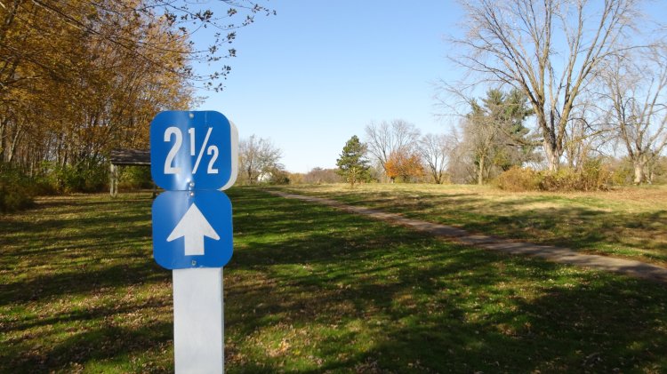
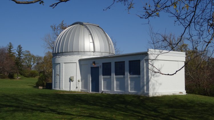
mile 1.3 Once you enter Donavan, bear left (west) onto a trail. This is a 5k high school cross country course so you should seemarkers and directional arrows throughout. Follow the course first heading west then turning right (north) after about 0.3 miles. Be sure to check out the observatory as you pass.
mile 2.0 Exit Donavan park near the intersection of W Northmoor and Sheridan roads.
mile 2.1 Cross W Northmoor at the stoplight. Proceed north on Sheridan road.
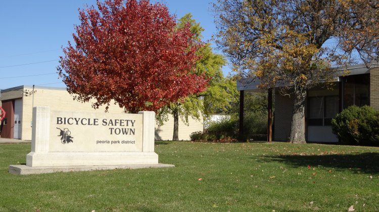
mile 2.4 Turn right into Bicycle Safety Town. Walk through the parking lot, heading towards the bicycle tire pump and connector path in the back parking lot.
mile 2.5 Exit Bicycle Safety Town onto the Peoria Greenway Trail (PGT). Head left (north) on this paved trail.
mile 2.6 At the stoplight, cross Knoxville avenue (parellels the PGT trail), and you will be on Giles Ave. Follow sidewalk anlong Giles heading east.
mile 2.8 Turn right onto Mt Hawley road at the T-intersection of Giles and Mt Hawley road.
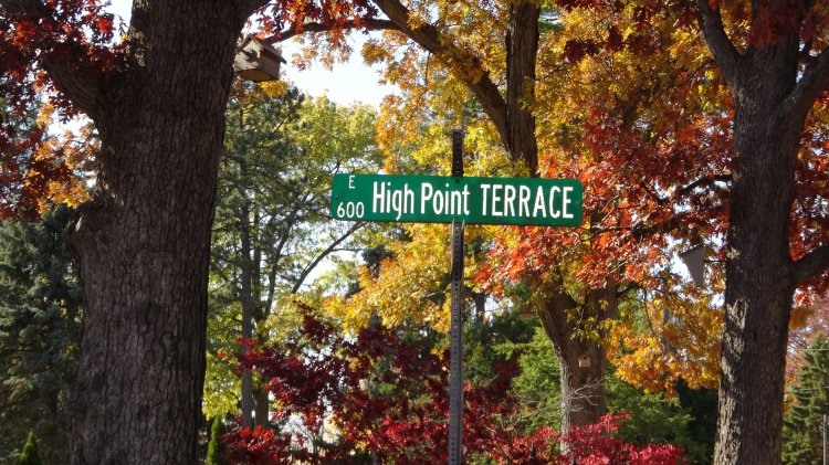
mile 2.85 Turn left (east) at E Highpoint Rd. This turn comes up quick, don’t miss it. Follow the sidewalk along the south side of E Highpoint road for almost 1 mile.
mile 3.75 You will come to a point were E Hightpoint Road ends and Highpoint Terrace – a No Outlet – road begins. Descend down Highpoint Terrace. Just before you begin your decent you will be at 790ft elevation. This is just 20 feet below the highest point in Peoria (810 ft) which is on private property a short distance away. Walk about 1/2 mile down this road.
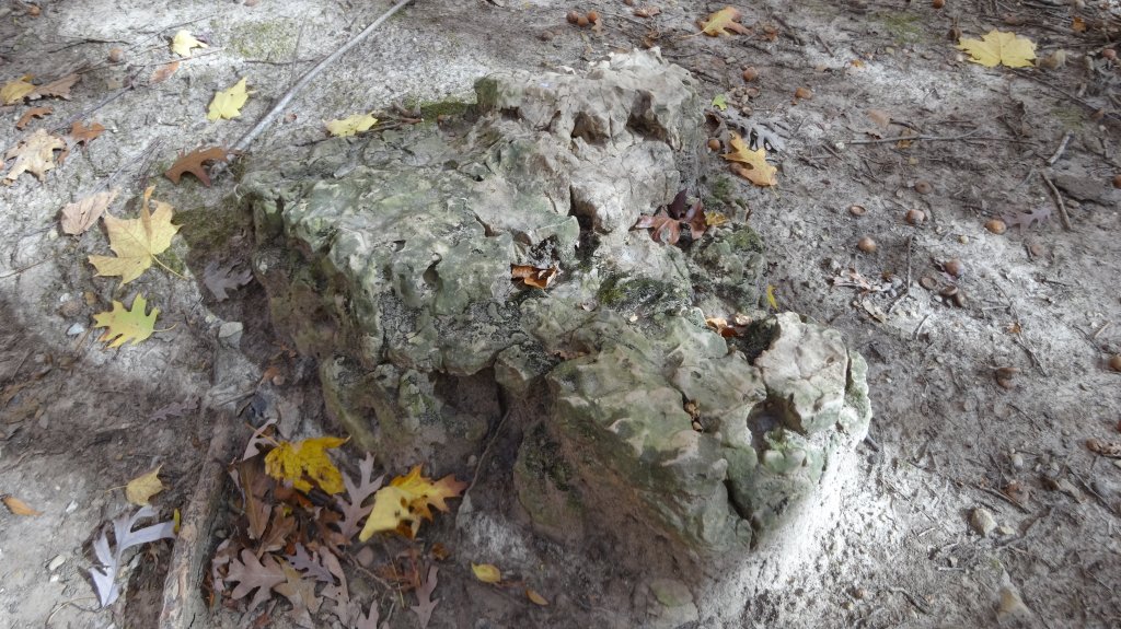
mile 4.25 When the decent ends, but before the road ends, watch for a large clearing in the trees to the left (south) side of the road. There will be a small triangular “Illinois Nature Preserve” sign and a rough trail heading into a floodplain. This is the far north end of the Forest Park Nature center which is part of the Peoria Park District (PPD). Turn left and follow trail heading towards the treeline.
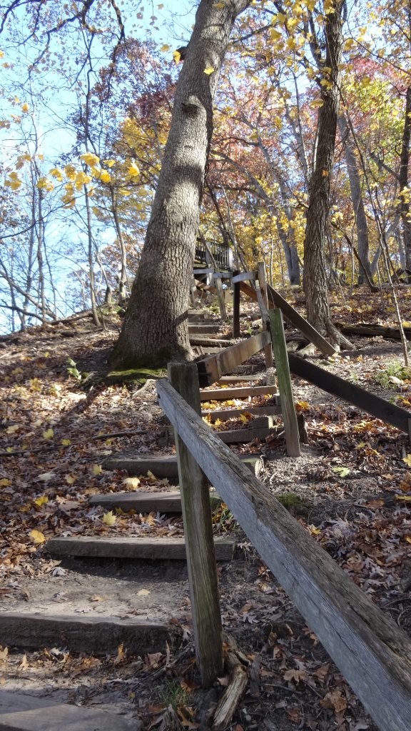
mile 4.4 Turn right at the trail sign for Wake Robin Trail. Follow trail Wake Robin Trail. You will soon come to stairs to climb. There is a nice deck at the top of the stairs which is one of the best places to stop for a break and snack along this route. Proceed along the Wake Robin Trail.
mile 5.0 Look for the Bee Tree trail sign and turn right. Follow trail. When you come to a sign for Possum Path Trail proceed straight.
mile 5.5 Turn right onto Wilderness trail at the signpost for Wilderness trail.
mile 6.0 Exit trail at the Forest Park Nature center parking lot. Ranger station building will be on your left with facilities if it is open. Exit the parking lot at the main entrance.
mile 6.1 Cross Forest Park road (carefully) and look for the Pimiteoui trail head. It will be almost directly across the road from the parking lot. Proceed up Pimiteoui trail.
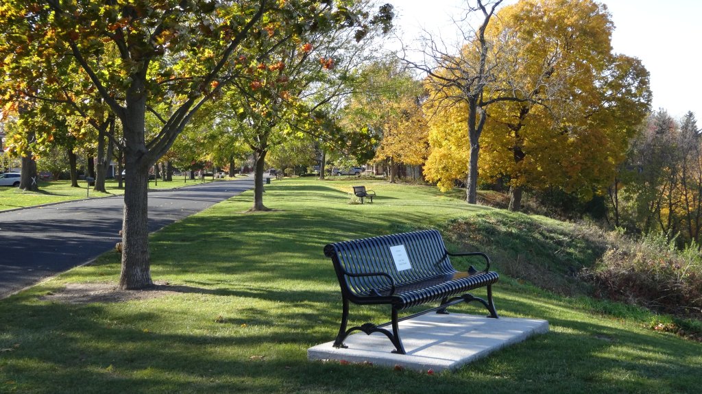
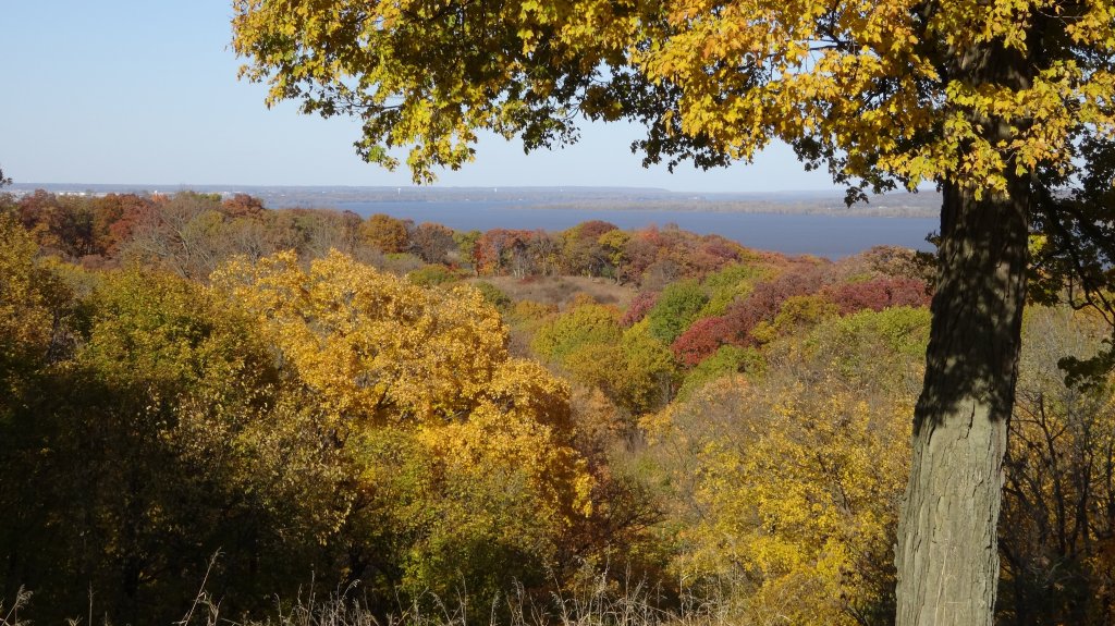
mile 6.9 Exit the Pimiteoui trail where it ends which is at the Grandview Drive overlook trailhead. Bear right (west) walking along the shoulder of Grandview drive. There are several park benches along this portion to rest and take in the view.
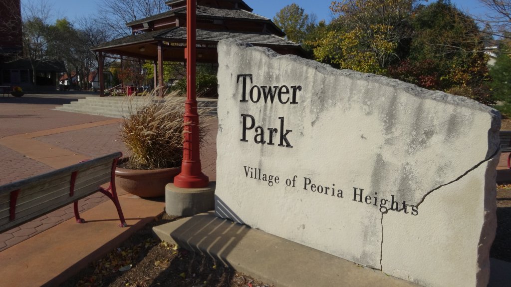
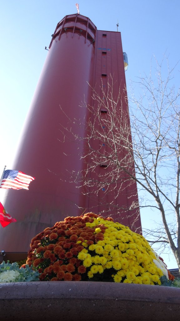
mile 7.1 Cross Prospect Road and enter Tower Park. The red cylindrical water tower in the park is impossible to miss. You probably spotted it long before this point. Be sure to take the elevator to the top if it is open. Elevevator is typically only open during Friday, Sat, Sun during the summer.
mile 7.2 Exit the Tower Park onto E Glen Avenue this is just to the south of the parking lot by the fire station that adjoins the park. Head right (west) down E Glen Avenue road.
mile 7.8 END. You are now back at the Peoria Heights High school where you started your journey.
