
Overview
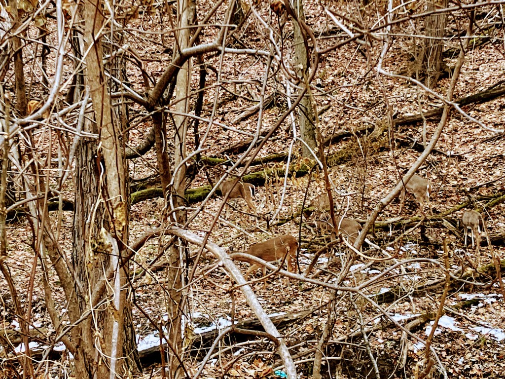
If you are looking for an easy 2.7 mile hike with all paved surfaces this is a good loop to do in central Peoria, IL. You get a good look at the historic Springdale Cemetery as well as an interesting view of the nearby bridges that carry US150 (War Memorial Drive) over the Illinois River. The hike is about 40% inside the cemetery and the rest on public trail including the newest section of the Rock Island Greenway Trail. I do recommend hiking this one with a friend if hiking in an isolated areas make you uncomfortable. This is because many portions are in areas not always well traveled depending on the time of day and year. I hiked it in December, mid-day. While I saw no other people other than my hiking companions, I lost track of how many deer I saw. You have a high probability of seeing deer at any time of the year. It is mostly a flat trail but there is one very steep hill inside the cemetery. However you will be going down that hill if you hike counter-clockwise as described.
Total Distance: 2.7 mile (loop)
Total Elevation Gain/Loss: 164 feet
Surface: Paved
Location of parking: 3301 North Harvard Avenue, Peoria, IL https://maps.app.goo.gl/7Qc3S1xPRsaxzRZ86
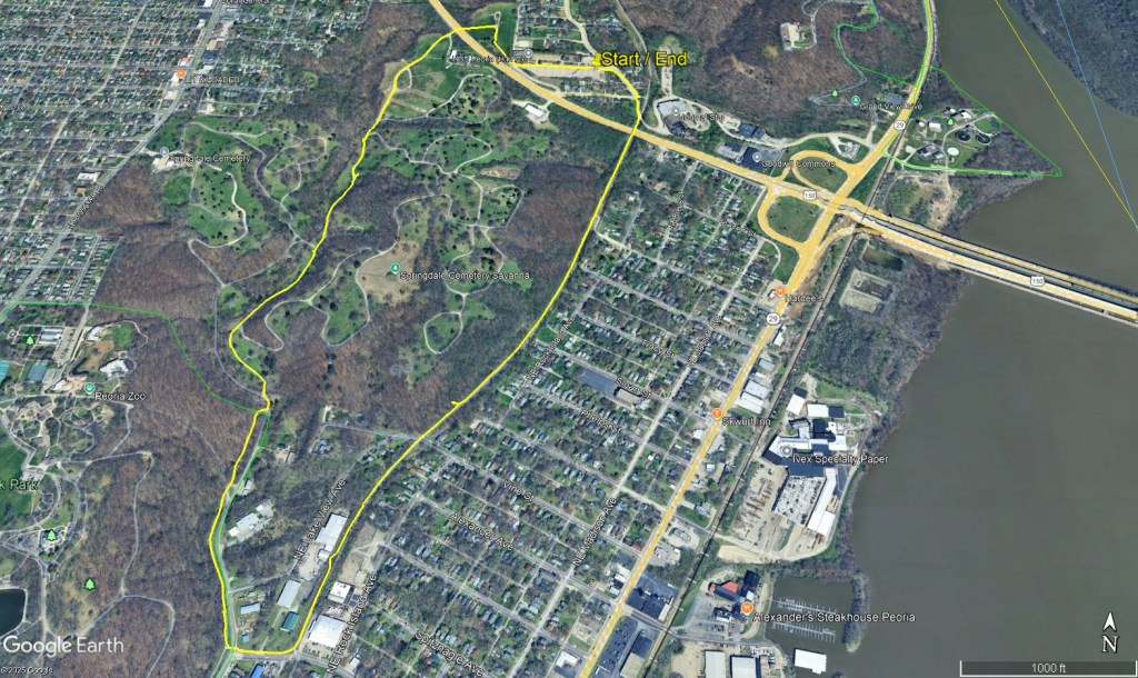
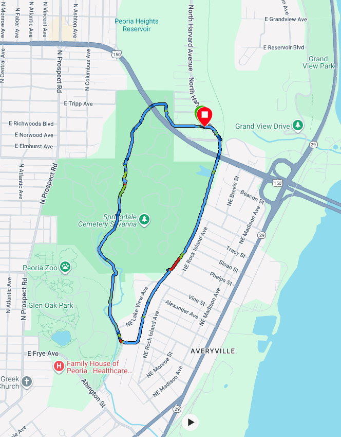
Description – Counter Clockwise
mile 0.0 – There are several places to park, but the very large parking lot at 3301 North Harvard Avenue is close to trail and off the street. While this is a private lot, it is currently (as of late 2025) not in use. After parking, proceed west towards War Memorial Drive and the Cemetary which is at the far end of the parking lot, opposite of Harvard Ave.
mile 0.1 – Enter the Springdale cemetery. There is a bricked gated, pedestrian only, entrance.
mile 0.3 – After a short walk through the northernmost portion of Springdale, you will cross under War Memorial Drive through a short tunnel. Proceed straight (south) through the cemetery’s main road
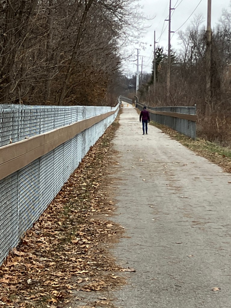
mile 1.2 – At this point you will leave the cemetery and pick up the Rock Island Greenway trail. It is to your right as you exit the cemetery at the far south end.
mile 1.5 – Turn to your left to take the trail where it crosses NE Perry Ave. This turn is approached shortly after you pass the PAWs animal shelter on your left.
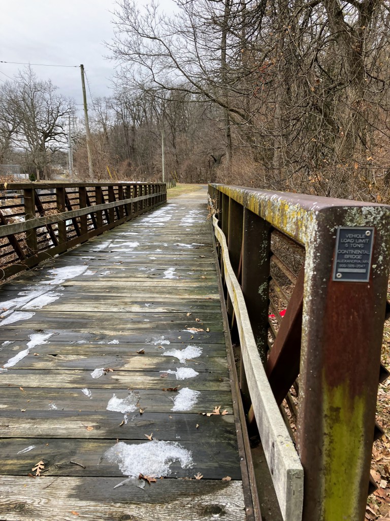
Mile 1.6 – After a short uphill walk, the trail will continue to the left. It will now be flat and straight from this point on as it follows the old Keller Branch Line of the long gone Chicago Rock Island and Pacific Railway Company.
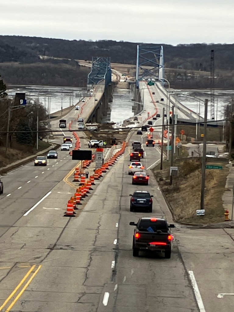
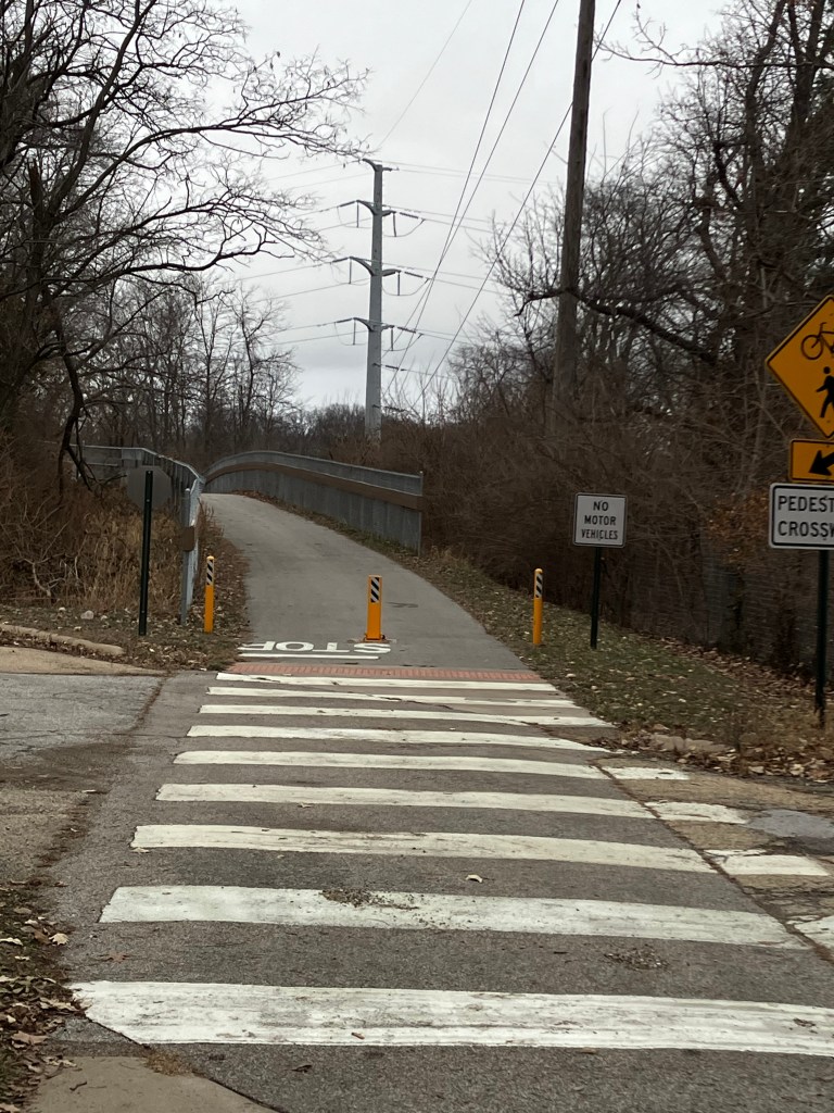
Mile 2.5 – This is where you cross an old railroad bridge over War Memorial Drive and have a great view of the two bridges over the Illinois River to the East. Shortly after you cross this bridge bear left and walk along Harvard Avenue to return to your car. Look for the parking lot on the left of Harvard Ave.
Mile 2.7 – Return to start.
